More rain anticipated, potential exists for localized flooding
By News-Argus Staff
Published in News on September 5, 2017 1:42 PM
 Full Size
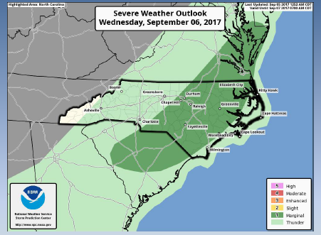
There is a chance of showers and thunderstorms this afternoon continuing into Wednesday.
An isolated strong or severe thunderstorm, mainly north of the U.S. 64 corridor, is possible today. The main severe weather hazard will be locally damaging wind gusts.
In addition, the storms will be accompanied by heavy downpours and frequent lightning.
A slow-moving cold front will trigger scattered thunderstorms across the eastern half of central North Carolina Wednesday and Wednesday evening. The area threatened is mainly east of U.S. 1.
Some storms could become severe with the main hazard being locally damaging wind gusts. In addition, heavy downpours may cause localized flooding, primarily in urban areas.
The threat of severe weather is considered marginal for the local area.