Winter storm update
By News-Argus Staff
Published in News on January 5, 2017 6:57 AM
 Full Size
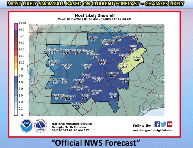
The National Weather Service in Raleigh expanded its forecast Thursday, indicating the central and eastern regions of North Carolina could face more snow this weekend than initially predicted.
A chart shows Goldsboro/Wayne County lies within a zone estimated to receive 4 to 6 inches of snow between late Friday night and Saturday afternoon. Earlier models had suggested a 1 to 2 inch accumulation after freezing rain moves into the area Friday and turns to snow overnight. Wilson could see as many as 8 inches of snowfall.
The new projection shows the overnight snowfall now lasting throughout the day Saturday, ending by about 4 p.m., but that is contingent upon temperatures staying cool enough. A few degrees warmer and that early freezing rain or sleet could last a while longer before turning to snow. If that happens, the accumulation could be far less, NWS data indicates.
This is an ongoing weather event. Updates to the forecast and potential county closings ---- Wayne County Public Schools has already suspended all after school and weekend programs and a Goldsboro disaster recovery resource fair scheduled for Saturday has been moved to Jan. 28 ---- will be made throughout the day.