DOT prepares roads as storm approaches
By Steve Herring
Published in News on January 21, 2016 1:46 PM
 Full Size
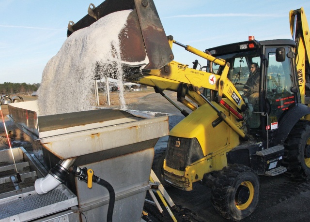
News-Argus/STEVE HERRING
N.C. Department of Transportation crews were busy this morning mixing salt with water to create the brine mix that is used to help keep roads from icing over. Other crews spread 35,000 gallons of the brine on county roads Wednesday and were back at it this morning in advance of an approaching winter storm expected to dump rain and possibly a wintry mix of sleet, freezing rain and snow on the area beginning tonight and continuing into Saturday.
State Department of Transportation crews began pre-treating the county's four-lane highways and two-lane primary roads Wednesday afternoon in advance of a possible winter storm.
Wayne County and much of eastern North Carolina will be under a winter weather advisory from midnight to 6 p.m. Friday.
Such an advisory means that periods of snow, sleet or freezing rain will cause travel difficulties and that motorists should be prepared for slippery roads and limited visibility.
Most of the state is under a winter storm warning from midnight until 6 p.m. Friday as a major winter storm is expected to impact the central part of the state.
The DOT crews were back out today hitting major roads with the brine solution designed to keep the roads from freezing over.
If the wintry mix that is forecast to start tonight includes ice, crews will hit it with salt, said Luther Thompson, DOT maintenance supervisor for Wayne County.
"My concern is that rain could wash it (brine) away," Thompson said. "Our other equipment is hooked up and ready to go. I hope it is all rain. For some reason I am not in the mood for snow."
Nearly 35,000 gallons of brine were applied on Wednesday with the same amount expected today.
Plows have been attached, and now it is a matter of waiting to see what happens, Thompson said.
Wayne County Public Schools officials are closely monitoring the weather, said Ken Derkson, public information officer for the school system.
Derkson said school officials would also be in close contact with the county's Office of Emergency Services.
Any delays or closings will be announced later today or early Friday, he said.
Today's forecast calls for sunny skies with a high temperature near 44 degrees followed by a 30 percent chance of freezing rain and sleet mainly after 5 a.m. Friday with little or no sleet accumulation expected. Freezing rain and sleet are expected before 1 p.m. Friday and then rain. Chance of precipitation is 100 percent. Little or no sleet accumulation is expected with less than 0.1 inch of ice possible. The high temperature is expected be around 39 degrees with winds up to 15 mph.
Rain is forecast for Friday night with a low around 35 degrees.
Rain is likely before 9 a.m. Saturday followed by a chance of rain and snow between 9 a.m. and 1 p.m. and then a chance of snow after 1 p.m.
Little or no snow accumulation is expected.
Saturday's high is expected to be 35 degrees with winds up to 17 mph and gusts up to 30 mph.
There is a chance of snow before 8 p.m. Saturday and then possible snow showers after 8 p.m. Sunday will be mostly sunny with a high near 43.