Severe weather possible this afternoon
By News-Argus Staff
Published in News on June 25, 2018 11:13 AM
 Full Size
Submitted photo
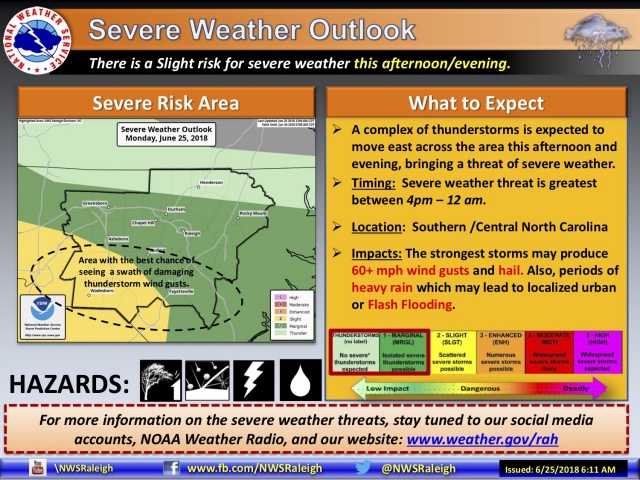
Wayne County and the surrounding area is under a marginal threat for isolated severe weather this afternoon that could produce heavy rain, hail and high winds.
The severe weather threat appears greatest between 4 p.m. and midnight.
Strong to severe thunderstorms are expected to develop and move east across central and southern portions of the state this afternoon and evening.
Unsettled weather is expected to continue for the next few days with slightly more moderate temperatures.
Today's high will be near 88 with an overnight low around 72.
Showers are likely and possibly a thunderstorm before 1 p.m. Tuesday, then showers and thunderstorms likely after 1 p.m. The high will be near 82.
There is a chance of showers Tuesday night with a low around 70.
There is a chance of showers and thunderstorms on Wednesday with a high near 88 and on Wednesday night before 11 p.m., then a slight chance of showers. The low will be around 73.