No major incidents as snow continues to fall across Wayne County
By Joey Pitchford
Published in News on January 7, 2017 1:31 PM
 Full Size
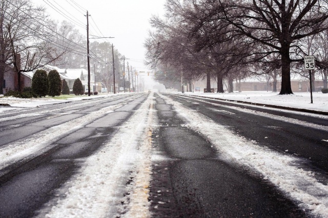
This photo, taken along East Ash Street in front of Herman Park Center at 12:29 p.m. Saturday, shows how a mixture of snow, slush and ice kept most city residents off the road. Snow continues to fall, and forecasts call for much colder temperatures ahead.
City officials asked residents to stay off the roads if at all possible Saturday, as a winter storm covered the county in a quarter-inch of ice and under an inch of snow.
With temperatures hovering just under 30 degrees, Goldsboro Public Works Department interim-Director Rick Fletcher said that the city had handled the storm well so far.
He said there had been no substantial incidents stemming from the weather as of around 10:30 a.m.
"There have only been a handful of people out, which is good," he said. "People know not to go out if they don't have to."
By that time, Fletcher said, salt trucks were gearing up to head back out into the city to cover important areas such as highway ramps.
Keeping roads from getting too hazardous is a process that has to be kept up with as conditions change.
Before the storm began, N.C. Department of Transportation and Public Works employees tackled major city thoroughfares such as Ash Street and Berkeley Boulevard, spreading salt and brine to combat the ice.
"The Department of Transportation came out and brined a lot of those places, which was great, but then we had all that rain which washed it away," Fletcher said. "We're on the cusp now where the temperature is dropping to where it will all start to freeze again."
By around 11:30, Duke Energy had not reported any outages in the Goldsboro area.
Fletcher confirmed this, saying that he had not received reports of any outages or power lines down.
As the temperature slowly dropped around noon, snow began to accumulate. Although the National Weather Service said that accumulation would total around an inch, those predictions appeared to have been exceeded by around 1 p.m.
According to the N.C. State Highway Patrol, officers responded to 145 collisions and 214 calls for service since 12 a.m. in the Troop C area, part of which includes Wayne County.
Highway Patrol dispatch was unable to confirm how many of those incidents occurred specifically within the county.
Seymour Johnson Air Force Base canceled some events and closed down several facilities ahead of the storm, including the visitor center and commissary. N.C. DOT also salted major roads throughout the base, according to a statement from SJAFB Public Affairs.
Monday is currently planned as a regular duty day for the base, according to a post on the base's Facebook page.
According to the NWS, precipitation was not expected to continue past Saturday. Freezing temperatures will persist until Tuesday, when highs will reach 46 degrees.
Temperatures are expected to reach their lowest Sunday night, when the NWS predicts they will drop to just 7 degrees.