Stormy weather expected in front of the Labor Day weekend
By Steve Herring
Published in News on August 31, 2017 12:23 PM
 Full Size
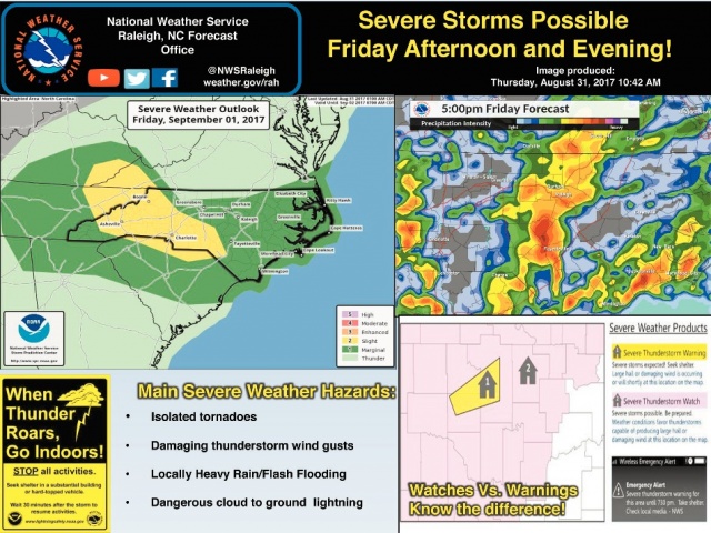
A stormy start to the Labor Day weekend is in store for much of North Carolina, which is at marginal risk for severe thunderstorms Friday afternoon and evening.
Stormy weather will continue into Saturday.
According to the National Weather Service office in Raleigh, a strong west-to-east oriented frontal zone will be located over the northern part of the state Friday morning.
It is expected to move southward during the day before stalling over the piedmont and sandhills.
Severe thunderstorms will be possible along and south of the front Friday afternoon and into Friday night.
The primary threats will be isolated tornadoes and damaging wind gusts.
Heavy rain and flash flooding are possible, especially in poor drainage areas.
In Wayne County, there is a chance of showers and then showers and thunderstorms after 1 p.m.
Showers and thunderstorms are expected before 2 a.m. Saturday and then showers likely and possibly a thunderstorm after 2 a.m.
Showers and possibly thunderstorms are likely before and after10 a.m. Saturday.
Sunday and Monday are expected to be mostly sunny with a high of 84 degrees on Sunday and 87 degrees on Monday.