Watching for ice
By Steve Herring
Published in News on February 16, 2015 1:46 PM
 Full Size
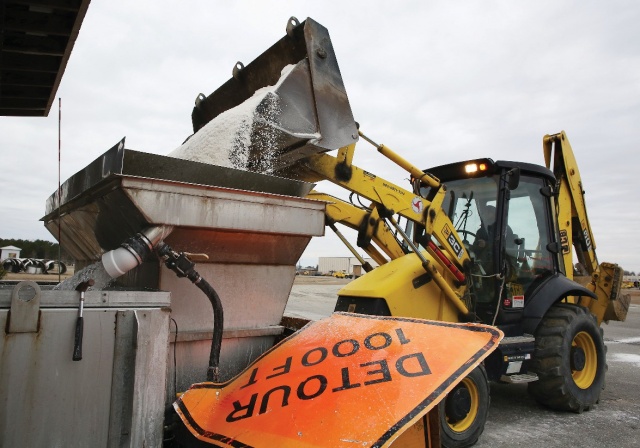
News-Argus/CASEY MOZINGO
A forklift operator loads salt into a brine-spraying truck this morning at the DOT facility in Wayne County. Crews were working today to prepare the county's roads for expected snow and freezing rain tonight and Tuesday. Forecasters with the National Weather Service are predicting as much as a half inch of ice.
Between a quarter to a half an inch of ice could blanket Wayne County before a winter storm moves across the area later today and into Tuesday morning.
A winter storm warning is in effect from 4 p.m. today until noon Tuesday and there is a chance of snow by around 5 p.m. However, the quick-moving storm is expected to drop mostly freezing rain on the area, with the heaviest accumulation north of Goldsboro and to the north and west of the county.
Most will fall overnight, said Mike Strickler, a meteorologist with the National Weather Service in Raleigh. Little to no snow accumulation is expected.
Not only will the freezing rain make for hazardous driving conditions, accumulation on trees and power lines could result in power outages, he said.
With a forecast high of near 36 with sunny skies on Tuesday some of the ice will begin to melt. However, as temperature fall into the mid 20s Tuesday night, any ice that melted will re-freeze, making Wednesday's morning commute treacherous as well.
Public schools were already closed today for Presidents Day, with the exception of Wayne Early/Middle College High School and Wayne School of Engineering. It is a teacher workday for teachers in traditional schools.
Officials with Wayne County Public Schools said they are monitoring weather reports and will be maintaining close contact with emergency services to determine any delays or closures for Tuesday.
No decision had been made by press time this morning on the county offices schedule.
By 6 a.m. this morning, 12 state Department of Transportation road crews were pre-treating the county's four-lane and primary two-lane roads with brine.
They will continue to do so throughout the day and will have work crews on duty overnight, said Luther Thompson, the DOT maintenance supervisor for Wayne County.
The brine is more effective against snow and sleet since it forms a barrier between the road surface and the moisture, he said. It is not as effective against freezing rain, which dilutes the brine.
The option then is to "hit it" with salt, Thompson said. How the storm develops will determine how crews attack it tonight and Tuesday, he said.
Also, crews will be staged across the county tonight to be better-prepared to treat the roads, he said.
Thompson urged people who do not have to travel to stay at home.
If they do have to be on the road, people should take their time, allow more time for making the trip, exercise caution and slow down, he said.
"I am ready for some spring weather," Thompson said.
Freezing rain starts out as snow. As the snow falls today it will pass through an area of warmer air between 5,000 to 10,000 feet aloft and melt. As it continues to fall it will hit the colder air mass and turn into freezing rain that sticks to surfaces.
Today's high will struggle to reach 32 degrees.
According to the National Weather Service, there is a chance of snow after 4 p.m. Snow and freezing rain is possible before 1 a.m. tonight then rain or freezing rain between 1 a.m. and 4 a.m. and freezing rain after 4 a.m. Tonight's low will be around 29.
On Tuesday there is a chance of freezing rain, mostly before 10 a.m. before tapering off by 1 p.m. The high will be near 36. It will be mostly cloudy Tuesday night with a low around 24.
Wednesday is expected to be partly sunny with a high near 37 with wind gusts as high as 30 miles per hour.
The bitter cold will continue through the end of the week with a high near 24 Thursday dropping to around 9 Thursday night. Friday is forecast to be sunny and cold with a high near 31.
Temperatures will moderate somewhat into the mid 40s on Saturday and near 50 on Sunday with a chance of rain.