Rains fall, roads flood
By Matt Caulder
Published in News on July 3, 2013 1:46 PM
 Full Size
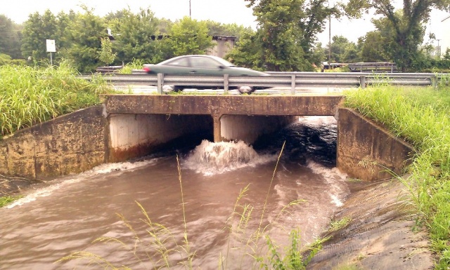
News-Argus/BOBBY WILLIAMS
Water rushes down the Big Ditch at Wayne Avenue following a downpour in Goldsboro on Tuesday. With almost daily showers and thunderstorms the past several weeks, the Wayne County area is soaked, with water standing in ditches and low-lying areas
 Full Size
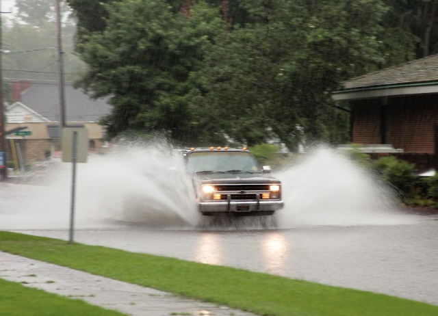
News-Argus/BOBBY WILLIAMS
A pickup truck negotiates a flooded Jackson Street near the Wayne County Public Library.
With Wayne County still under a flash flood watch through this evening, area officials are preparing for the Neuse River to reach flood stage Thursday.
Thirty-one counties, including Wayne, remain under a flash flood watch.
In Goldsboro, sections of two streets were closed to traffic Tuesday following heavy rains: Grantham Street between John and James streets, and Greenleaf Street between Raynor and Brogden streets.
The streets were closed by the state Department of Transportation and the city of Goldsboro, respectively.
In other areas of the county, teams were working in the north and south ends, placing high water warning signs and closing roads if need be, said Luther Thompson, county maintenance supervisor with DOT.
High water signs were placed on N.C. 55 West, Country Club Road and Thunder Swamp Road in Mount Olive, Mt. Carmel Church Road in Pikeville and Indian Springs Road in Seven Springs.
"We have team ready to go out from both ends of the county," Thompson said Tuesday. "We have certain areas that we know to look out for when it rains like this."
The North Carolina State Highway Patrol usually works from a reactionary stance in the case of flooding relying on the public to report flooded roads, said Sgt. Jerry Burke.
If a road is reported flooded, the highway patrol will call the Department of Transportation to come close the road off to traffic.
"We work hand-in-hand with DOT and watch levels of the Neuse coming out of Raleigh," said Burke.
The National Weather Service shows the Neuse River to be rising again and it is expected to reach flood stage -- 18 feet -- late Thursday, creating problems for some low-lying areas near the river, where it is likely to overflow its banks near the bridge over state road 1915 and upstream from the U.S. 117 bridge.
The river is expected to crest late Friday and early Saturday at about 18.5 feet.
Public Works Director Jose Martinez has public works personnel clearing out drains that have been clogged to lessen flooding on city roadways, but some streets had too much standing water to locate the drain until the rain stopped.
While keeping drains clean to avoid rain water pooling in the streets is an ongoing job, during heavy rain events Martinez has his department focus on those areas that are prone to flooding, in addition to their usual efforts.
"Usually straw from work sites is one of the worst materials for clogging drains, so we like to find out how much construction is upstream before storms like this," said Martinez.
Natural materials such as leaves and grass clippings also create problems in a number of drains.
Scattered showers are predicted throughout the day today and there will be a slight chance of thunderstorms on Independence Day, though the day is predicted to be mostly sunny with a high of 89, said a National Weather Service forecast. Friday there will be a chance of thunderstorms in the afternoon with a high of 88.