Possible severe thunderstorms expected as cold front moves in today
By News-Argus Staff
Published in News on August 23, 2017 8:54 AM
 Full Size
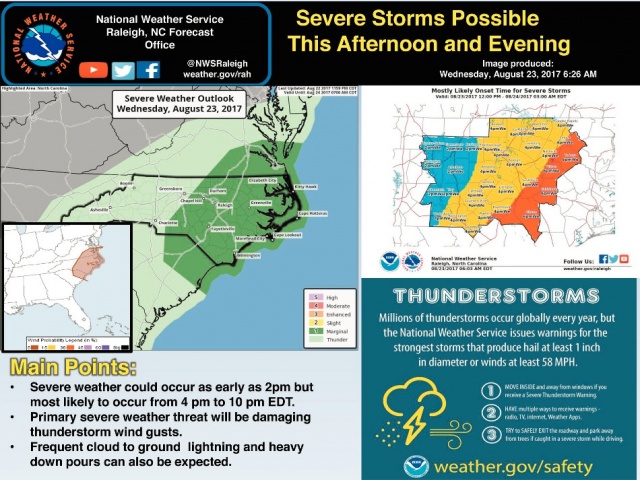
Scattered thunderstorms, some that could become severe, are expected to develop this afternoon and evening, ahead of a strong cold front moving into central and eastern North Carolina.
The greatest threat could come from damaging thunderstorm gusts. Frequent cloud-to-ground lightning will also pose a threat.
In Wayne County, there is a chance of showers and thunderstorms, mainly after 5 p.m. today, according to the National Weather Service in Raleigh.
Showers and thunderstorms also are likely , mainly between 8 p.m. and 2 a.m.
The chance of showers continues into Thursday.
The cold front will usher in cooler temperatures. Today's high will be 92 degrees with Thursday's high at 82.
Friday will be a little warmer at 85 with a cooler weekend with highs of 83 on Saturday and 81 on Sunday.